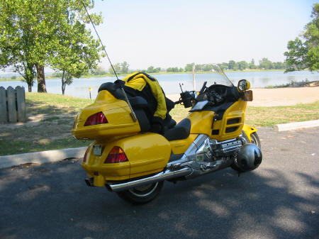
September 6
|
|
I
had planned to leave around 5 AM, but not everything got done the night before,
so I decided to have an easy morning and leave whenever I felt like it. I woke
up around 5, got up and did some paperwork, repacked one of the saddlebags to
save some space, had coffee, played with the kittens, and read the paper. Hey,
this is a vacation, not a race, right? I left the house right at 9am, temp was
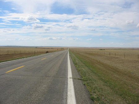
81 degrees as I motored out of Lynn Haven, up 77 to 20 and over to 331. The goal
for today was to get close to St. Louis, since tomorrow is to be spent at the
Museum of Westward Expansion at the Gateway Arch. I hoped to be there when the
doors opened at 9. I had traveled most of this route before, but decided to take
331 instead of 231 north to Montgomery, since I had not traveled 331 as much.
Skies were clear as I left home but they quickly clouded over. I had eaten some
yogurt before I left the house, but within 20 miles, I was hungry. How as I
supposed to make time if I stopped to eat so soon? On the other hand, it's my
vacation, I should enjoy it! So I stopped in DeFuniak Springs for breakfast at
the local Waffle House. Eggs, grits, and bacon; good, hot, fast, and cheap. I
love Waffle House! As I walked out to the bike, a few sprinkles were falling,
but they did not last long. I rode past the DeFuniak Airport, which had been the
destination on my first solo cross county flight...I chuckled as I remembered
that I flew that whole leg with the flaps down! Then on up though Florala, with
it’s beautiful cypress-ringed lake. As I rode along, I didn't feel “into
it”...I felt sluggish, tired...I had gotten plenty of sleep and had eaten
well...I didn't know what the problem was. However, as I approached Montgomery,
it began to pour rain, and continued until well after I had gotten on I65. As
the cold rain came through the open vents of my jacket, I perked up, and by the
time the rain quit, I was alert, awake, happy, and singing along with the tunes
on the stereo. That had done the trick! Shortly after leaving Montgomery, a
little Nissan pickup with 3 boys in it pulled up beside me. The driver gestured
that he wanted to race! I laughed and politely declined, he smiled, waved, and
floored his little truck, causing more noise than speed. He veered off on the
next exit and was gone. |
Saw an ultra light around Decatur.
No problems in Nashville, traffic
moved great, and I didn’t even notice Kentucky state line.
Took a room in Paducah around 7:30. I
had wanted to camp, but with the late start, I decided to ride past dark and
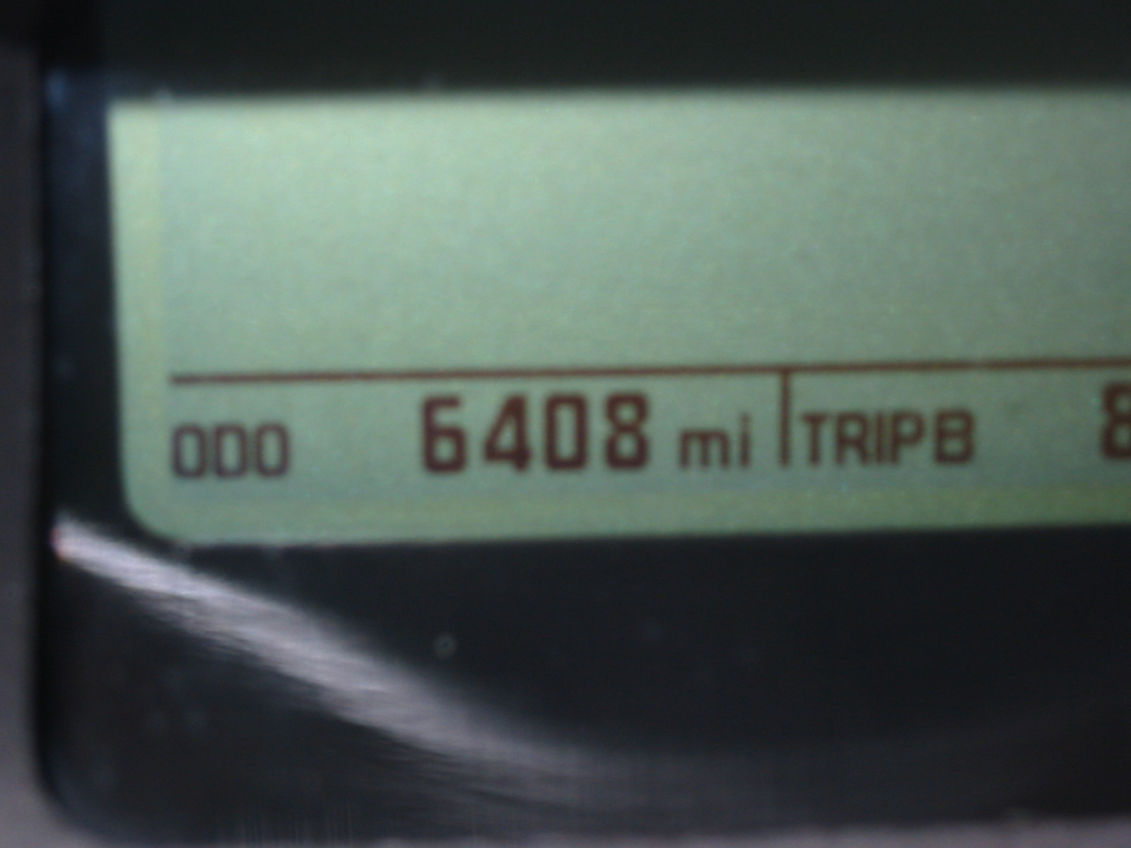
take a room. 606 miles for the day.
September 7
|
|
Had
a good nights sleep, up at 4, out at 5, into the dark. 59 degrees. Oddly, I was
hungry...I am hardly ever hungry in the morning.
I rode through town, thinking I would find a Waffle House or something like it,
but no luck. Finally found a Hardees and had a steak biscuit and a cup of
coffee. Then, back on the interstate at 5:45. The first hints of dawn were just
showing up in the east. As I crossed the Ohio river, I could see a couple of
barges moving along upriver as the dim light reflected off of the waters
surface. The temp had dropped to 55 and I was a bit cold even with my jacket
buttoned up all the way. The dawn came clear, and even though the temps did not
rise, the dew point did, burning off the patchy fog that lay low in the valleys
and raising the wind chill. It was a glorious morning, light traffic and
wonderful scenery. There was still a bit of low-lying fog as I topped a hill and
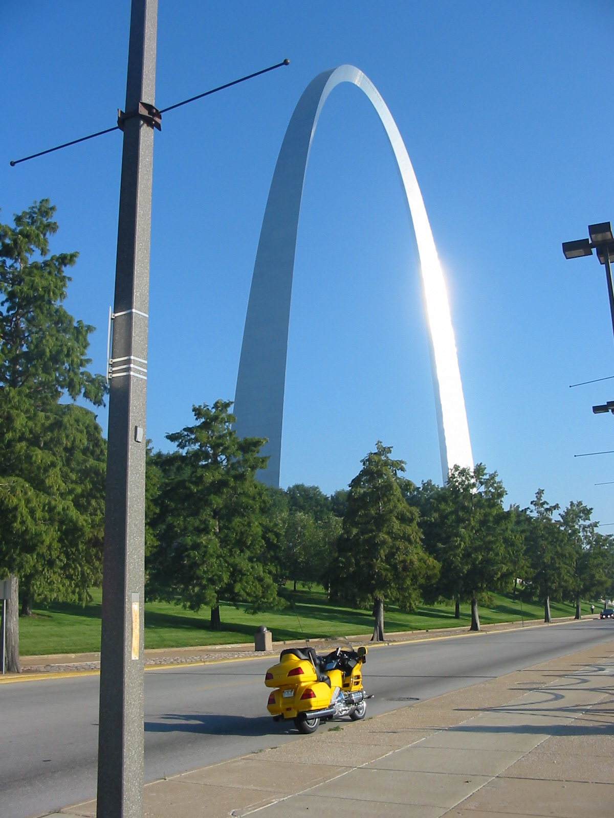
caught my first glimpse of the Gateway Arch in St. Louis. NOW my trip was really
beginning...this had been the first goal...to go the place where LC had struck
off from civilization into the unknown. My spirits soared as the Arch glistened
in the morning sun...the past 750 miles had just been filler, boring interstate
travel. Now the trip was finally
getting started.
|
|
|
I arrived at the Arch at 8:30 as the
sun beat off the last little bit of fog from the Mississippi. I had only seen
the Arch once before, from a car passing by on the interstate. This time I rode
slowly by on the riverfront, soaking in its size. I turned around and rode back,
and since traffic was light, stopped in a no-parking zone for a pic. Then to the
parking garage (the sign said $6 but she only charged me $4), when I got parked
I pulled out the cell phone and called Mom to check in and tell her where I
was...we chatted about the time she had been here some years ago. I made some
pics, and then entered the underground part of the park when it opened at 9. I
bought tix to the big screen movie, titled The American West, which had great
photography but corny story lines, and the tram to the top of the arch. Then I
went in the Museum of Westward Expansion, which was very good. Not only did it
have a huge LC section, but there was also a timeline of historical highlights
from 1800 until well after the Civil War. I was amused at the "politically
correct" presentation of some events, and noted the pictures of Robert E.
Lee and Jefferson Davis were not identified…you had to know the face to figure
out who they were. History is not
kind to losers.
|
|
|
Something was said in the movie that
I thought was interesting. The
definition of where “The West” started was a moving target for many years.
To Columbus, it was the eastern seaboard. To
Daniel Boone, it was the Appalachians. To Thomas Jefferson, it was the Mississippi.
I had only recently come to understand why the central states were called
“the Mid-West”. Looking at a
map, they are not “west” at all…the term remains from the time when the
Mississippi River was the nation’s western boundary. Abraham Lincoln, born in
Kentucky and living in Illinois, was considered a “westerner”.
How things change! |
There was almost no one in the museum
when I started, but things were crowded when I left at 12. Walked to the bike
and found my Snickers bar had melted...it was 79 degrees, and felt hotter, so I
rode in shirtsleeves. Took 70 to 94, and soon saw my first LC trail sign. I had
thought that the road would have regular river views...wrong...but what a fun
road! Hilly, with lots of twists and turns, narrow, and very little shoulder. It
reminded me a little of Virginia. Rode through lots of towns with populations of
44, 127, 82, and so on. There were lots of vineyards, dead cornfields, and a low
green crop that I didn’t recognize…soybeans, maybe? Beautiful farms. An
otter scurried across the road in front of me.
I crossed to the south
side of
the
river at Jefferson City, and was impressed by the way the Capitol commanded the
river bluff. However, the country on the south side of the river was not as
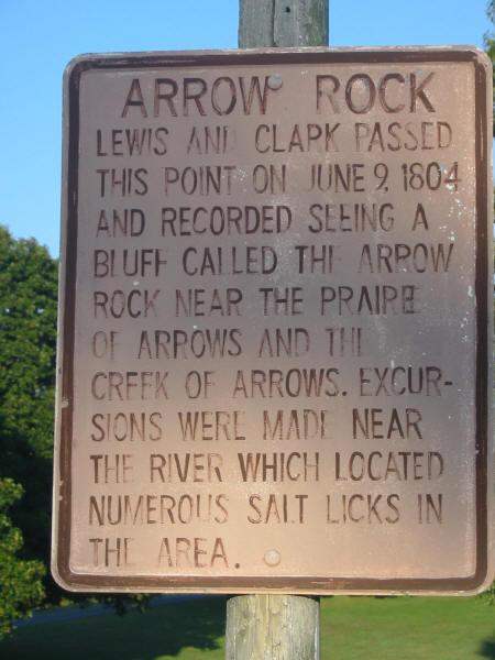
pretty as the north. Rode on to Arrow Rock, where the state park was split into
two sides, the powered RV side and the unpowered tent side. I was the only
person on the tent side. The camp host said that he set his telescope up on the
adjacent hillside every night, and invited me come out and stargaze.
I had good cell service, so I spent a while on the phone with Lana,
warmed a can of soup for dinner, and turned in.
Somewhere along the way, one of my
fog lights blew out.
I forgot to write down my mileage for
the day.
|
|
|
September 8
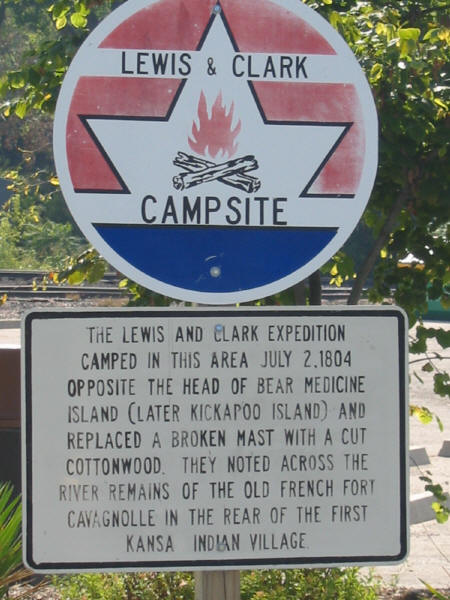
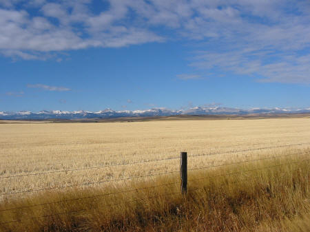
Awoke at 3:30, then back to sleep and up again after dawn. I showered in a spider-infested stall with a strange valve system, then made a cup of coffee and hit the road around 8...later than I had planned. The ride was flatter than before, not as twisty, rolling hills with more straights. The corn was dead and in some places was being cut. Ran 64 to 24 into Kansas City, which has to be one of the most depressing cities I have ever seen. Then 45 north. I took a wrong turn at Weston (beautiful little town), the sign said the trail went that way, and led me into the town but did not show the way out! But before I backtracked, I found a LC campsite on the river that I would not have found otherwise.
|
|
|
|
|
I
passed through
another town whose only purpose seemed to be to host farm equipment dealers....
machines with huge tall skinny tires like I had never seen before.
Listening to a local FM station, I heard ads for cattle yards, stud
service, and diesel mechanics. The
air, for hundreds of miles, had a faint sweet smell.
The fields were full of corn and soybeans...the corn was mostly dead,
some cut, but further north, some was still green...a second planting, or
different hybrid? But the coolest thing today was the soybean fields...the wind
moving over them rippled the leaves and looked like zephyrs moving over an
emerald sea. Thousands upon thousands of acres.
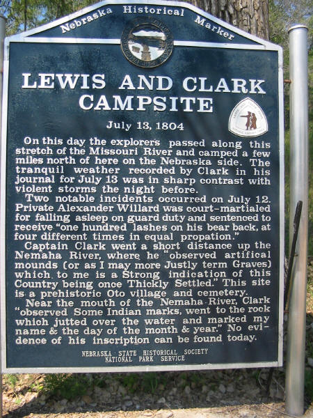
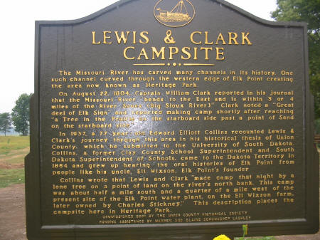
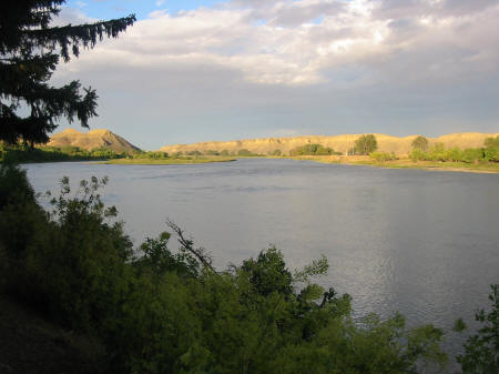
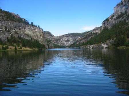
I stopped at Lewis and Clark State Park, just across the river from
Atchison, KS, and had the park pretty much to myself.
I sat at a picnic table on the river and ate a couple of cans of tuna
fish for lunch. Somewhere along the way, I crossed an
old steel bridge over the Missouri that was only 13 feet wide…I sure would
hate to meet a semi coming over that bridge! |
|
|
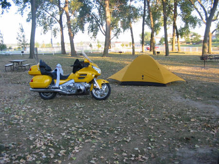
Stayed
at the city park in East Sioux City...I was going on to push on further, but
realized that the grave of Sgt. Floyd was close by, and I didn’t want to
backtrack. It was not the park of
my dreams...it was right on the river, but right in the city...there was a noisy
road close by, and apartments across the street...but they did have good
showers, and it was only $10. There were lots of leaves on the ground, autumn
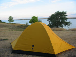
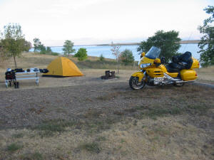
was in the air. It was also breezy, which made pitching the tent a bit of a
challenge, and maybe 70 degrees. There
were a couple of other motorcyclists camping there, so we chatted a bit, then I
set up the stove and had a dinner of soup and tequila, and turned in for the
night. 400 miles of great roads today.
|
September 9
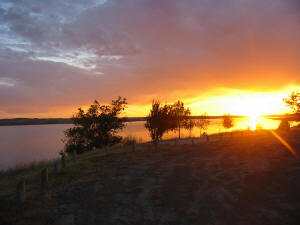
As I write this I am sitting at a
picnic table in the Indian Creek Campground, outside of Mobridge SD. It is 10
after 9. My tent is pitched on a small bluff directly on the Missouri River. The
sun has been down for about an hour, and I am looking up into a partly cloudy
sky with a full moon. The campground is deserted. All I can hear are crickets
and a few night birds. No traffic, voices, or human noises of any kind. Across
the river, I can see only one man-made light.
I cannot imagine a setting that more embodies what I wanted out of this
trip than this.
The
day started at 5 AM when I rolled out of my sleeping bag and broke camp. The
campground had been noisy...I had been awakened by trains and barge horns
several times. Still, I tried to be quiet as I tore down. Light sprinkles were
falling as I motored out at 6, looking for breakfast and headed for burial site
of Sgt. Floyd, the only LC expedition member to die on the trip. It was still
dark as I crossed the river; the bridge was lit with purple lights from below
and was gorgeous. Saw a Perkins and made a beeline for it. Struck up a
conversation with the lady at the next booth, she was a retired army physical
therapist from Swainsboro, GA, who now lived in Sioux City. We talked about LC,
the Civil War, good books, and the cultural significance of grits. I would have
been out sooner, but hated to break off the conversation. Out the door at 7 and
at the Floyd monument as the sun came up. Then on 29 north for a bit of
interstate time, headed for Vermilion, then to Yankton. Saw a LC sign at Elk
Point and turned off to investigate, there was a campsite there.
|
|
|
I discovered that most of the trees
in this area were not natural, they were planted.
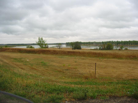
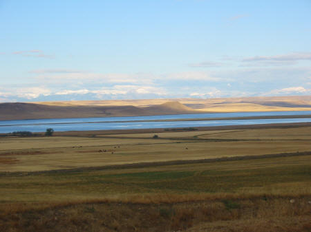
Coming back to the interstate I saw a lot of rain in the distance. Weather radio said a cold front was coming through, so I expected unsettled weather all day. Off I29 at Vermilion, on Hwy 50 to Yankton. On the way I saw the sign to Spirit Mound and turned off, got several miles before the road went to gravel...I considered pressing on, but didn’t want to deal with a gravel/mud road in the rain. So I turned around in Yankton and found an auto parts store that had a bulb for my blown fog light...I hoped to get that changed out soon. Took 81 south back into Nebraska, across a double-decked bridge. On the Nebraska side there was a LC-themed visitors center that I did not know about, with a stunning receptionist that could have been a movie star. I checked weather radar there, and found that all the rain was to the south of me. The beauty queen suggested that I take Hwys 12 to 281, which both turned out to be wonderful roads, some twistys and some nice areas down low in the marshes. As I entered Niobrara, I saw a historic marker by the roadside, and pulled over, thinking it would be about LC. It wasn’t, and I rode away with a heavy heart.
|
|
|
I ate lunch in a bait-and-tackle shop
at Pickstown, then took Hwy 50 to Platte, then 45 to I90 for a short interstate
run. Skies were now partly cloudy and temps climbed into the 80's…what
happened to my cold front? The
6 mile stretch on I90 to pick up 50 again reminded me of why I ride the
two-lanes…all day I had fun roads and great scenery, but those 6 miles on the
super-slab were ugly and boring. All
those people out on I90 had no idea what they were missing.
I was really in the plains by this
time...the only hills were right by the river...otherwise it was flatland and I
could see for miles. Sky bright blue with fluffy clouds. I saw my first buffalo
out there…one lone animal standing in a thousand-acre field.
LC wrote of seeing buffalo herds stretching to the horizon, estimating
that they could see 10,000 at a time. Gone
forever.
I cruised along Hwy 34, a great road
right beside the river. I stopped at a rest area on a bluff overlooking the
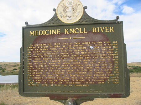
confluence of the Missouri and the Medicine rivers for a break and a snack.
As I studied
my map, a diesel pickup pulled in and shut down, and a short Indian man, with a
cowboy hat on and a chokehold on a Budweiser, approached.
He looked at the bike and said “Harley Davidson?”
I stifled a laugh and said “No, sorry, Honda”.
“Where you from?” “Florida.”
Pause. “Where you headed?”
“Oregon.” Longer pause.
“What’s in Oregon?” “Don’t
know.” Really long pause. “So
you are kind of like Forrest Gump, right?”
That busted me up! We
chatted for a while, shook hands, and as I was leaving, he said “Remember, you
are in Indian country, watch your scalp!”
I thought that, considering history, I should be warning him to be wary.
But I just smiled, thanked him, and rode away.
|
|
|
|
|
At
Pierre, the temperature hit 90 degrees. Is this really the Dakotas in September??
Here, I had to make a decision...stay here, or push on to Mobridge...the
campground at Mobridge sounded nice, so I decided to move on. Took Hwy 1804
(numbered after the year that LC ascended the Missouri, the road on the west
side is 1806, the year they came back) as much as possible, not many river views
but nice country. The roads were
mostly arrow-straight, and I hadn’t seen a speed cop since I had entered the
Dakotas, so I cruised at 85 and 90. A
few grouse walked out in front of me, and I wondered what road-killed grouse
tasted like…but I didn’t get to find out. |
Into the campground about 6:30, with
511 miles for the day.
|
|
|
|
September 10
Rain. Cold. Wind. But a warm room and
a steak dinner at the end.
|
|
|
|
|
|
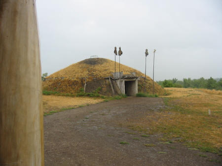
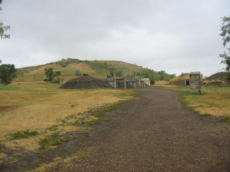
North on 63 to 24, and up 1806. The clouds spit rain at me all the way to Mandan, with temps hovering around 63. Went to Abraham Lincoln State Park, where there is a re-creation of a Mandan earth lodge community, and the rebuilt site of George Custer's headquarters. It was from here that he set out for the battle at Little Bighorn.
|
|
|
A rangerette gave me directions to a library in Mandan, so I headed that way and
checked email for the first time of the trip. 110 messages, only 4 of
importance. I get SO much spam! As I left the library it was
raining in earnest,
and the wind had picked up, out of the east. Crossed back to the east side of
the river and rode 1804 and 83 up to a large LC Interpretive Center and the
reconstruction of Ft. Mandan, where LC spent the brutally cold winter of 1804. I
got a lot of sympathy from the ladies at the center as I walked in dripping and
shivering (temp was down to 53). The center was great, very good displays and
information. From there I rode to
the fort replica (the original site has been lost). No pix due to the rain, I
didn't want to get the camera wet. After I looked at the fort, I went to the
bike, grabbed my maps, and sat down in the visitor’s center to figure out what
to do. I had checked Weather.com in Mandan and knew that I would have rain as
far as I could ride...and I was cold, hungry, and tired. My plan had been to be
in Williston, ND, right on the Montana line, tonight, and take a hotel, since I
didn't want to make camp in the rain. With some help from the lady at the desk,
I determined that Williston was 189 rainy, windy, cold miles from where I was,
and it was 3pm. I could be there by 6. Sure, I could do that!
I dug out the electric jacket and prayed a prayer of thanks to those
wonderful folks at Gerbings...it kept me toasty warm. My plan was to head north
on 83, a 70mph divided 4 lane, to 23, then turn west, running with the wind to
Williston. I would get all the crosswinds out of the way on 83, and just sail
along with the wind for 2 hours on 23.
The wind shifted.
What had been an east wind turned, by
the time I reached 23, to a north wind. So if I followed my plan and turned
west, I would have 2 MORE hours of crosswinds (NWS said they were gusting to 35
MPH) to deal with. Not interested. I decided to beat into the wind for a few
more miles to Minot, ND. I found a Comfort Inn that had an indoor pool, hot tub,
laundry, a gazillion channels of TV, and an Appleby's next door, for $50.
Downright extravagant compared to my recent digs, but hey, ya gotta live a
little, right?!
I had really wanted to visit the
Knife River Indian village...I forgot completely about it.
I had also wanted to camp in the area
of the Mandan villages, to stay a night in the area that LC had spent 146
nights.... but the weather drove me off. I guess I am a wimp...LC had days on
end of sub-zero temps when they were here!
256 miles today.
September 11
The 2-year anniversary of the world trade center terrorist attack. The news channels were covered up with memorial services. I thought back to that day, watching the second plane hit, live on CNN. I felt as angry today as I did back then.
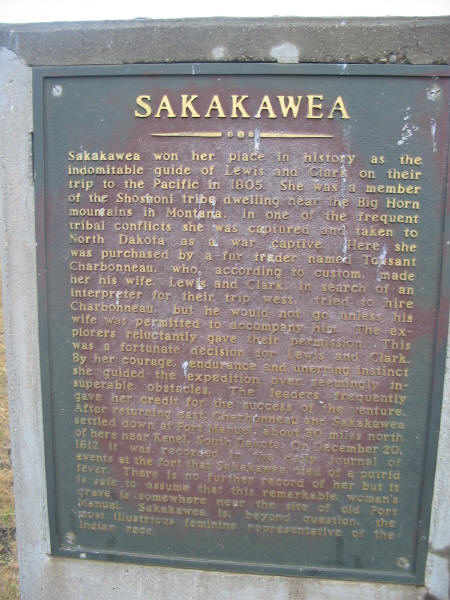
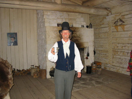
I got up at 5 after a sound night's sleep. Messed around and got out at 6:15. There was just a tint of light in the eastern sky, mostly cloudy, 53 degrees. I put on the heated jacket and stayed toasty as I headed west towards Williston. There was very little wind, and I knew that most of the wind I would get today would be right on the nose, no crosswinds. I would burn a bit more gas, but it would be much easier riding. I watched the sunrise in my mirrors, hoping for a good photo op, but the clouds were too heavy. Stopped for gas and a hearty breakfast in Williston. Tried to make small talk with the waitress, who was eating her breakfast right next to me at the bar, but she wasn't in the talking mood. Then back on the road for the long haul across the Montana plains. But before that, I stopped at Ft. Union, where a costumed park employee offered me coffee in a tin cup...delicious! I met an English couple there who had traveled to the US 16 times, always renting a car and exploring the National Parks. I also saw an Indian "bullboat", a boat made of willow branches covered by a buffalo hide. They used them mainly for downriver travel (being round, it wouldn't row too well), and they supposedly could carry a huge loads.
|
|
|

|
|
I decided last night to take US2, the "high line", named after the
Great Northern Railway route that it
parallels.
It is wide-open country, running through towns with European sounding names like
Malta, Glasgow, and Havre. This is remote country, so I decided to get gas every
time I got to half a tank, which, running 80 into a 10-20 mph headwind, was
every 100 miles or so. The towns along this route are ranching towns, and some
looked pretty sad, with boarded up stores and shops. I saw one abandoned church
up on a hillside with big rough wooden crosses in the cemetery out back.
The country is flatflatflat, I could see for miles over the
fields...mostly hay. |

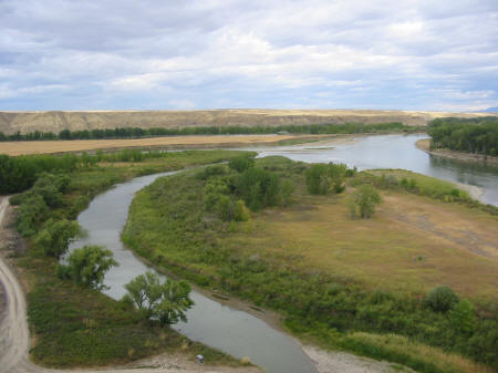
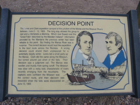
The Missouri was in view to the south until Nashua, where the river moves south and the road moves north. At some point the scenery changed a bit, there were trees, where before there were none. My goal for the day was to see the Marias River confluence, where LC had spent 9 days trying to figure out which river was the Missouri. The confluence was at Loma, just a short way down a gravel road. From the bluff, it seemed easy to me to determine which was the main river, but the guidebook says that it can be confusing in the late spring when both rivers are swollen with runoff.
|
|
|
From
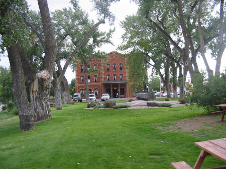
there I headed about 10 miles into Ft Benton. I am really glad I stopped here.
This town boomed during the steamboat days...75% of the freight bound for the
Pacific Northwest unloaded here to transfer to wagons for the land trip over the
Rockies. It was a wild, lawless, bloody frontier town. Now it is quiet,
peaceful, pretty, and struggling to make a dollar or two from tourism. The
waterfront was idyllic, but there were several storefronts that had been empty
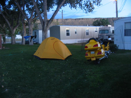
for quite some time. I found an RV park "and horse motel" at the
western edge of town, next to the fairgrounds. The proprietress, Sandy, a
friendly woman with a small herd of cats, set me up on a patch of grass close to
the bathhouse and in the lee of some permanent trailers. It was blowing pretty
well, and she said that Great Falls (not far to the west) was forecasting gusts
to 60 mph
|
|
|
|
|
|
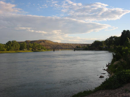
I pitched my tent and worked on my
fog lights, to no avail. As sundown
approached, I rode downtown and walked the waterfront, took pictures, and had a
mediocre steak dinner.
535 miles today.
September 12
It rained and blew a bit last night, but I got a good night’s sleep, and by the time I was ready to break camp the rain had stopped (for the moment). As I broke camp, the lady in the trailer next to me with an awful cough went out to walk her dog and spoke. “Where ya from?” “Florida.” “Oh my goodness! Where ya going?” “Oregon.” “Oh my goodness!” She seemed to have a bit of a limited vocabulary. I danced around a bit waiting for someone to vacate the one-hole bathhouse, then broke camp and got on the road. Temp was about 50 and dropped down to 45 as I headed to Great Falls. It was raining again by the time I got there, and the weather radio predicted scattered showers all day. I wandered around town looking for a breakfast place and finally found a Perkins. After that I hustled off to the Lewis and Clark National Historic Trail Interpretive Center that I had heard so much about. I got there at 8:45 and waited outside for it to open at 9. The staff felt sorry for me, standing outside in the wind and rain, and let me in early. They were mainly older volunteers who were all big LC buffs. One guy was really funny, but seemed to forget which joke he had just told, and tended to repeat himself. The center was GREAT, wonderful displays, and I sat in on two talks, one about LC boat designs, the other about the fur-bearing animals of the area.
|
|
I left there
at 12 and hotfooted it to the Gates Of The Mountains. I decided that I would not
have time to make Three Forks today, as that would put me even further south,
and I had to meet Lana in Glacier National Park tomorrow...so Gates Of The Mountains
would be as far south as I would go today. Got more rain on the way, raining as
I arrived, POURED as I was waiting on the boat, and then cleared off and we had
beautiful blue skies about 15 minutes into the tour. A wonderful area, worth the
trip and the $11 admission. I can see why Lewis was so impressed. Off the boat
at 4…now, where to spend the night? Helena was south, wrong direction, and all
of the campgrounds with showers were east of town, even further in the wrong
direction. Every campground to the north and west for quite a ways was
primitive, and I really wanted a shower. The closest option was a KOA back in
Great Falls. I don't like to backtrack, but after a few minutes consideration,
that is what I decided to do. So I beat back to Great Falls, and left the
beautiful blue skies for more rain and crosswinds. When LC had been portaging their canoes (which, loaded,
weighed over 4,000 pounds) 18 miles around the
falls, they had built wheeled carts from cottonwood trees to carry the
boats. When the winds rose, they
erected sails on the boats and sailed them on dry land!
They have some serious wind in these parts. |
The KOA was worth the rain, wind, and
drive thru rush hour traffic. Great facility, wonderful private baths in the
bathhouse (heated), and shelters to keep the tents out of the wind and rain.
Expensive at $20, but it sure was nice! 208 miles
September 13
|
|
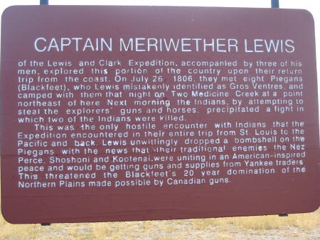
It got into the low 40's last night, ended up sleeping in a thermal shirt, socks, and fleece pants, as was still a touch cold...all in a 20 degree bag. You would have to grow fur to be comfortable in that bag at 20 degrees! Got a little rain last night, and it was still cloudy when I got up. Loaded up and hit the road, headed up Hwy 89 to Glacier National Park. The clouds moved on and the sun came out, bright blue skies, no wind, and temps moving up into the 50s. 89 is a very nice road, flat over the plains for a while, then getting twisty as it approaches Glacier. It also passes the Two Medicine Fight Site, where Lewis and his group fought a small band of Blackfeet and killed two of them (the only Indian casualties of the expedition). Somewhere in that area a small river otter crossed the road in front of me. |
|
|
|
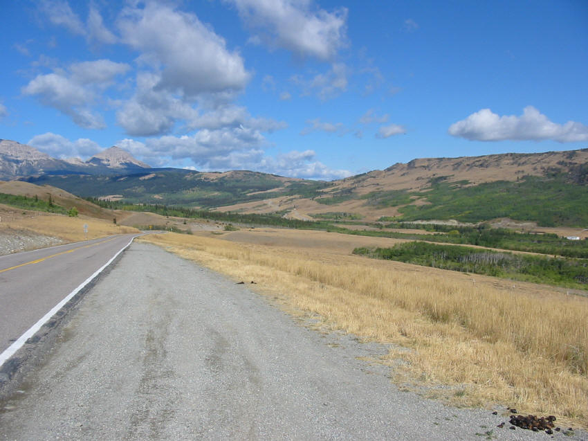
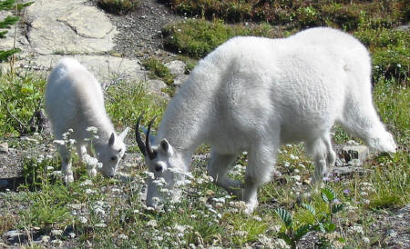
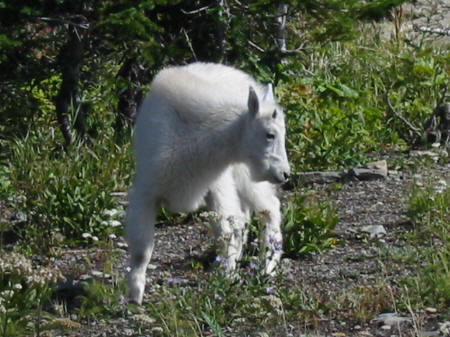
Rode to St. Mary’s and entered the park, riding the Going To The Sun Road westbound. Temp at Logan Pass was a balmy 48. Just over the pass, a mountain goat nanny and kid were grazing right by the roadside, and I got some great pictures.
|
|
|
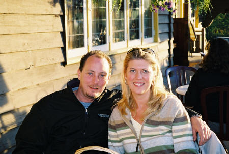
Headed down into Apgar and checked in, the room was ready even though it was not even 2pm. I found out that the eatery in the village was already closed for the season, and that no place opened for breakfast before 7...I wanted to be out earlier than that, so I bought some granola bars and beef jerky for breakfast food, and stopped by a pay phone to call my parents. As I was on the phone to them, Lana drove up in her rental car from Bozeman. We went back to the room, unpacked her car, and then I took her on a bike ride up to Logan Pass and back.
|
|
We went to West Glacier for dinner at the Benton Inn, and commented to the waitress how nice the weather was. She said that two weeks previously, the smoke from the forest fires had been so thick that she could not see her car parked in the lot across the road! |
270 miles today.