October 20
Gettysburg.
In the spring of 1863, Robert E. Lee decided (for the second time) to invade the North. When the Civil War started, the Southern strategy had been to wage a defensive war. But Virginia had been turned into a wasteland by the constant fighting, and Lee and Jefferson Davis thought that an offensive strike at the Union capital in Washington would bring a swift end to the war. So he marched the Army of Northern Virginia up to the west and north of Washington, hoping to descend upon it from the north and capture it. Largely by accident, his army met the Union army under General Meade at the sleepy little Pennsylvania town of Gettysburg.
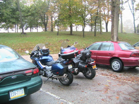
We had breakfast at the hotel, and loaded up the bikes. They were soaked from the rain the previous night, and even though is was still cloudy and in the low 50’s, at least it was not raining this morning. Since we had passed all the cool little mountain roads that I had planned to take yesterday, and I didn’t feel like backtracking, we ran US 15, a boring but fast road, up to the battlefield. What today is US 15 was called the Emmitsburg Road in 1863, and was the road running through the shallow valley that separated the two armies during the main part of the battle. As we entered the park, we could see the sillouettes of monuments rearing up out of the foggy gloom. A few more miles brought us to the main parking area, situated on the ridge where the Union troops were positioned. Over 500 men died in the area that is now the parking lot.
|
|
|
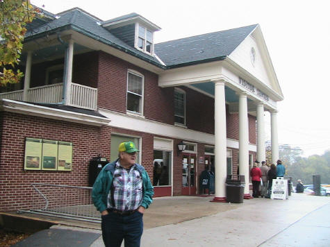
We first went to the museum, which was showing it’s age, but was packed with displays and information. Here Eric really began to get a feel for the war that had been a part of my life from childhood. He was born in California and raised in Alaska, where the Civil War was kind of a distant, obscure event. He has always been a quick study, and he soaked up the information in the displays and pummeled me with questions. The museum and the displays and films at the visitor’s center were excellent. I could have spent the whole day inside, but the real story of Gettysburg is out on the battlefield.
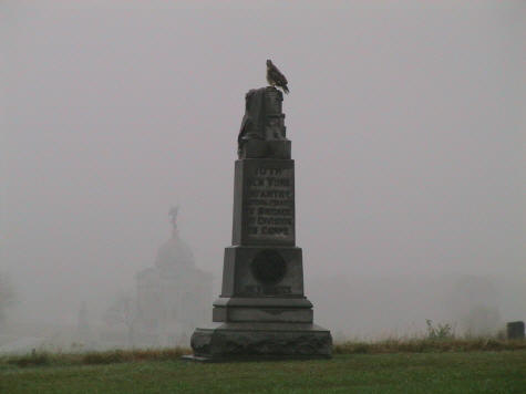
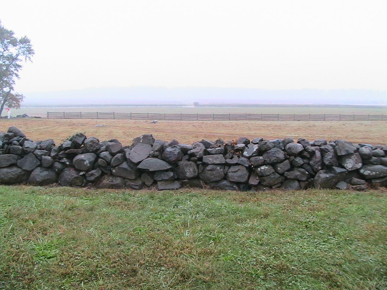
It was after noon when we emerged onto the battlefield. South of the Visitor Center are the Union positions on Cemetery Ridge. Today, that ridge is topped with monument after monument to the Union dead. On the face of that ridge is a low stone wall which the Union troops used for cover as the Confederates advanced. The ridge looks out on a shallow valley (the one that US 15 runs up), and between ¾ and 1 mile away stands another parallel ridge, this one wooded, called Seminary Ridge. It was here that the Confederates gathered for the assault on the Union forces. On that July day in 1863, the weather was hot and the skies were clear. On this October day, the weather was chilly, and the mist obscured the ridge across the way and made the monuments looked ghostly. I thought that the dreary weather was appropriate.
|
|
|
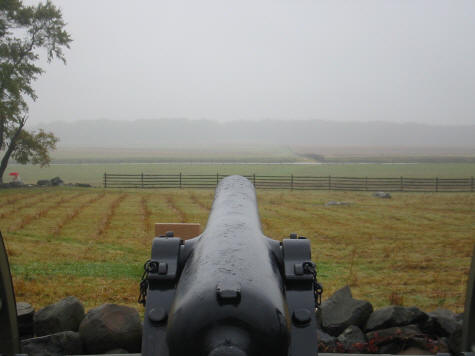
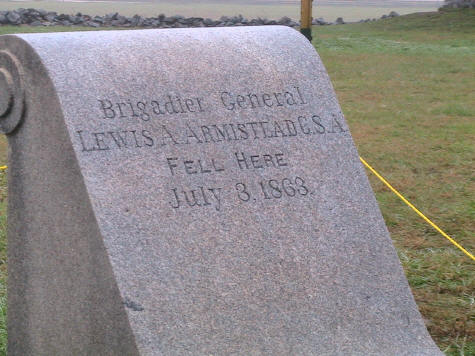
We walked the Union lines and looked out on the fields that 12,000 men had marched across, in the face of artillery and musket fire. We crouched behind the wall that the Union gunners had crouched behind. We sighted over the cannons. We walked over the wall and looked back, at what had been the last sight that thousands of men had seen. We thought about how terrifying it must have been to be 17 or 18 years old, marching in that maelstrom of hot lead and smoke, stepping over the mangled bodies of your countrymen. We saw “The Bloody Angle”, a 90 degree turn in the wall where some of the heaviest fighting occurred. We saw the monument where General Armistead had fallen, as he lead the only group of Confederates to break the Union line that day, shot by men commanded by the Union general Hancock…one of Armistead’s closest friends. We saw a monument where a North Carolina regiment got to within 10 yards of the stone wall, only to be decimated by a load of double canister fire. We saw the Copse Of Trees that Lee told Longstreet to take, over Longstreet's objections that it was impossible. Behind the Copse was a monument called “High Watermark of the Confederacy”. It marked the deepest Southern penetration of the Northern lines that day. It also symbolized the beginning of the end, since many historians consider the Southern defeat at Gettysburg the end of the Confederacy, even though the fighting continued for two more years.
|
A Union Gunner's View. |
The Stone Wall, Union Side. |
|
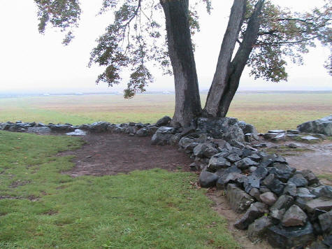
The Bloody Angle, Union Side.
|
Armistead fell here. |
|
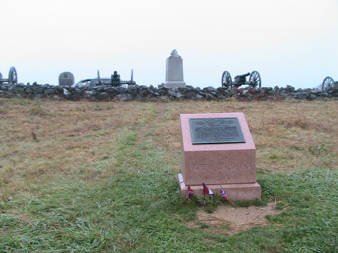
26th North Carolina fell here. Double canister at ten yards. "Sgt. Olney cried out 'Fire that gun! Pull! Pull!' The number 4 obeyed orders and the gap made in that North Carolina regiment was simply terrible"...Union artilleryman
|
The Copse of Trees.
|
|
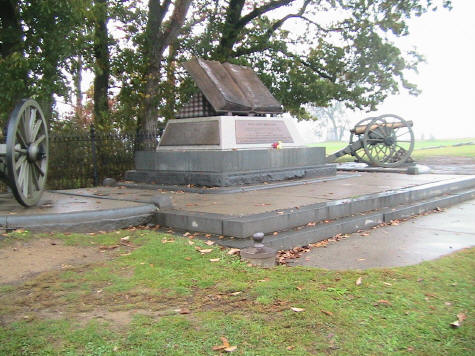
The High Watermark of the Confederacy |
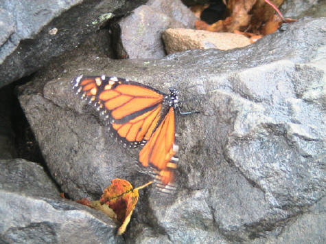
A bit of life and beauty at The Bloody Angle.
|
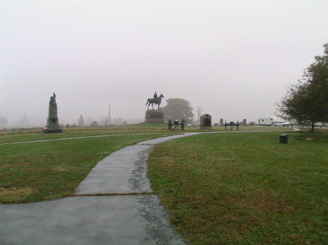
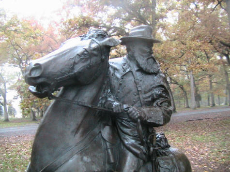
By now, it was around 1:30, and we were hungry. The town of Gettysburg has grown up to the edges of the park, so we mounted up the bikes and rode into town, finding a little deli/coffee bar near the main square. After lunch we continued on the driving tour route, which leads to sites to the north and west of town, which saw action early in the battle. Then we headed back south, and rode down the Confederate lines on Seminary Ridge. The mist still obscured the other side. We rode to a large monument of Lee. It was from this spot that he directed the battle, and near here, late in the day, Lee instructed General Pickett to reform his division in the trees in case of a Union counter-attack. Pickett responded “General Lee, I have no division”.
We walked a trail along a stand of trees and came to the point where Lee, late in the day on July 3, sat on his horse and told his troops stumbling back from the battlefield “It’s all my fault. It’s all my fault”. Over 6000 Southern bodies littered the field that day, one-quarter of them being from North Carolina.
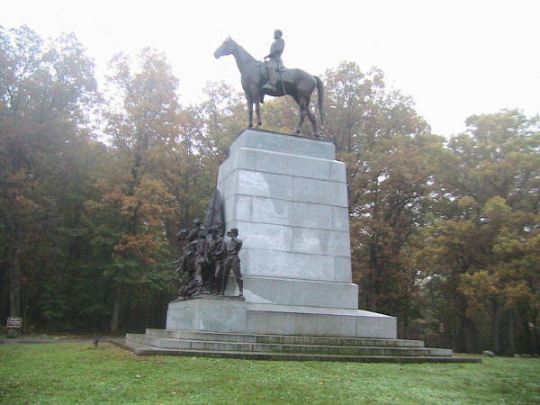
Lee.
We left this point, and walked the field, just as those Southern soldiers had done 141 years ago. We tramped through the mist and the knee-high grass at the same pace that they would have marched. I couldn’t help but wonder what it would have been like…smoke obscuring the landscape, stepping over bodies of dead men and horses, the cries of the wounded, the deafening thunder of artillery, solid shot whizzing by, opening gaping holes in the ranks, then, as you drew closer to the stone wall, canister fire and musket volleys. It took us about 10 minutes to reach the wall. For us, a peaceful yet somber stroll. For them, hell. For many, death.
That walk was a deeply emotional experience.
|
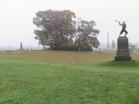
Longstreet |
Back on the other side, we mounted the bikes and continued to ride down the Southern lines. We came to a statue of Longstreet, a Brigadier General from Georgia that Lee called “my old war-horse”. Longstreet had begged Lee not to attempt a frontal assault here. He had scouted Union positions to the south, around some hills called Big Round Top and Little Round Top, and found them undefended. He suggested (correctly) that the Confederates could flank the Union lines and roll them up. Lee would not listen. He was determined to go up the middle. I have always wondered why. Lee would usually try a flanking move every chance he got. He was not long from his most stunning victory, at Fredericksburg, where he had fought from a fortified position very similar to the one now occupied by the enemy, and not one Union soldier had broken the line…they had been slaughtered. With that experience, how could he send his men against a similar objective? Some historians say that Lee was sick and not thinking clearly. But perhaps Lee described it best when he later said, “I thought my men were invincible”. |
From the Longstreet Monument, we continued south to the area that Longstreet had scouted, today called Devil’s Den, the Slaughter Pen and The Valley of Death. By the time that Southern forces made a move on this area (July 2), Union troops were dug in on the high ground. It was said that the Southern troops could hear the Northern troops felling trees and digging gun pits the whole night. This is not the most famous area of the battlefield, but more men fell here on the 2nd than did between the two ridges on the 3rd. By the time we got there, it was drizzling and the light was fading. I stopped and plucked a few leaves from a maple tree that was blazing with fall color to send back to Lana. We walked the Union positions on Little Round Top and imagined the rocky valley below littered with thousands of dead and dying men.
We left the park at dark in the rain. I remembered that the defeated Southerners had trudged back to Virginia in the rain. Perhaps it was an omen. They had been soundly defeated, and the day before, on July 4, word arrived that Vicksburg, Mississippi, a supposedly impregnable Southern stronghold, had fallen to General U. S. Grant after a long siege. The tide had truly turned against the South.
We rode in the rain, looking for a hotel. We had earlier heard that there were hotels on Route 30, but I went the wrong way and we rode quite a distance before I decided to turn around. We went back through town and found a hotel with a Perkins restaurant within walking distance, and called it a day.
If you are interested in the Battle of Gettysburg, the National Park Service has an excellent overview at http://www.nps.gov/gett/getttour/main-ms.htm. I would also recommend Ted Turner's film on the battle, called simply Gettysburg, starring Martin Sheen, Stephen Lang, Jeff Daniels, and Tom Berenger. It is available on DVD at a lot of movie rental stores like Blockbuster or Movie Gallery.
We did not have time to visit the Gettysburg Cemetery, which was dedicated to the Union dead several months after the battle. Lincoln was invited to the ceremony almost as an afterthought, and was given the opportunity to speak. The speaker before him spoke for two hours. Lincoln spoke for two minutes. Yet that short address became one of the most powerful statements in our nations history. You can read his speech here.